A Tale of Two Marylands: How the Chesapeake Bay Bridge United the Free State

For me, each crossing of the Chesapeake Bay Bridge is a thrill. The panoramic views up and down the broad Bay from the Bridge’s 186-foot apex is worth the expense of any toll or lost time stuck in traffic. Living west of the bridge—more than nine in ten Marylanders do—the eastbound descent onto Kent Island offers the promise of escape and impending adventure.
Formed by a meteor that hit the Atlantic seaboard 35 million years ago, the 80-mile-in-diameter Chesapeake impact crater beneath the Bridge separates the Delmarva Peninsula to the east from the rest of Maryland west of the Bay. Yet prior to July 1952, when Governor Theodore McKeldin led the first car parade across the newly-finished Bridge, the only ways to fully behold the Bay’s majesty were from above by plane or at the waterline in a crossing ferry.
The Bridge’s 4.3-mile spanned arch provided a third, purely man-made perch from which to marvel Maryland’s most majestic natural feature.
As it turns seventy this summer, what has the Chesapeake Bay Bridge meant for wanderlust-filled Marylanders?
The Chesapeake Bay Bridge was a fits-and-starts project Maryland officials first considered in 1907. Politicians dawdled, and early momentum was stalled by the onset of World War II. Finally, in 1947, Governor William Preston Lane Jr. and the Maryland General Assembly authorized construction, which began in January 1949 on the bridge’s Sandy Point western terminus in Anne Arundel County. When the first span was completed in 1952—the second, parallel span was added in 1973—the Bay Bridge was the world’s “largest continuous over-water steel structure.” In 1967, the state rededicated the bridge and honored Lane’s contributions by officially appending his name to it.
Almost thirty million cars traverse the Bridge each year. Even with the addition of the second span, Marylanders bemoan the frustrating traffic backups to cross the bridge, especially during weekends and holidays in the summer season. Everyone has a favorite horror story, probably several. I have been stalled on Route 50-301’s eastbound approach as far back as the Severn River Bridge. Others have shared with me far worse tales than that. Reaching the Bridge is the signature progress marker of any cross-Bay road trip.
The central paradox of the bridge is that it connects yet also distinguishes the state’s two main sections. Sharing with Delaware the Peninsula’s cultural and economic identity, the Eastern Shore’s nine lowland counties—which comprise a third of Maryland’s total landmass—arguably fit better as part of the First State than the Old Line State. The Shore is and will forever remain geographically and culturally detached from the rest of Maryland, but the Bridge has done more to unify a state that the Bay divided long ago.
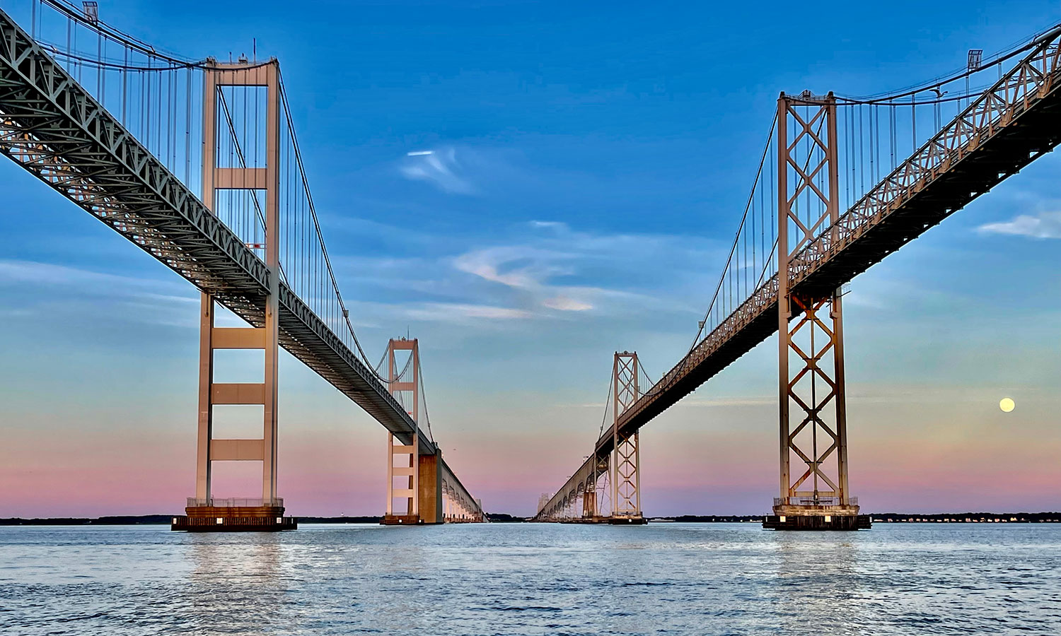
The Bridge replaced slower and costly boat ferries—or the equally cumbersome land routes around the Bay’s northern tip via Harford and Cecil counties—with a short, miraculous drive. Overnight, the Bridge facilitated the spending of a week, weekend or even a day trip to the Shore’s charming small towns and cities. On a good day, motorists from Baltimore or Washington can reach Kent Island within an hour. Small towns like Easton and Chestertown are but another 30 minutes beyond Stevensville’s eastern terminus.
The reverse trip matters as much, if not more. Prior to 1952, Eastern Shore natives could reach not only Wilmington or any other point in Delaware, but even Philadelphia faster than their home state’s largest city, Baltimore, or state capital complex in Annapolis. To see a new governor sworn in, attend a grandkid’s graduation in College Park, or catch an Orioles game at Memorial Stadium—or Oriole Park in the pre-war era!—required planning and a commitment to either get across the Bay or around it. Deep Creek Lake may as well have been the moon.
The Bridge dramatically altered the state’s population profile, too. In the first half of the twentieth century, the population of the Eastern Shore grew just 7 percent while the rest of the state expanded by a whopping 97 percent. Since 1950—the last census before the Bridge opened—the Shore’s population more than doubled, and Ocean City’s burgeoned about seven-fold. Although the rest of Maryland grew faster during the past seven decades, the Shore’s growth since 1950 would have been substantially lower without the Bridge.
In 2008, journalist David Guth published a study of news coverage during the statewide debates over whether Maryland ought to build such a bridge. Guth found that “conquering nature” and “unity” were the most common themes expressed by newspapers across the state.
More interesting was how opinions—and fears—diverged.
Not surprisingly, Shore newspapers worried that the Bridge posed a threat to their insular culture. They feared that an influx of both tourists and new residents would disrupt their bucolic lifestyles. Meanwhile, some Marylanders from the more urban, western shore counties dismissed the potential benefits of connecting with the state’s most remote region. To commemorate the Bridge’s fiftieth anniversary in 2002, Baltimore Sun columnist Dan Rodricks nicely summarized these split sentiments: “Convinced there was no need for civilized people to visit the Eastern Shore, H.L. Mencken had dismissed the bridge proposal as ‘ridiculous.’ Ocean City investors loved the idea, but most of the Eastern Shore worried that the bridge would ruin their peaceful, rural lives. Private ferryboat companies opposed it. Shipping companies saw it as a navigational hazard.”
With the benefit of seven decades’ hindsight, the Bridge obviously failed to homogenize the opposing sides of the Chesapeake. Despite the reasonable fears expressed by its natives, the Eastern Shore’s unique culture has survived mostly intact. Sure, its quaint cities and towns are more crowded. Primary and especially secondary homes have become pricier to own or rent. Yet the essence of the Shore endures: long and scenic backcountry roads, the tempting waft of shucked oysters and steamed blue crabs caked with Old Bay, annual waterfowl hunts and festivals, the sound of wind-ruffled boat sails, and the relaxing pleasures of sipping summertime drinks dockside at sunset. And, of course, dockside communities from Baltimore City harbor and across the five counties that line the Bay’s western edge—St. Mary’s, Calvert, Anne Arundel, Baltimore and Harford—long shared a waterman-based economy and identity before construction began.
To say the Bridge connected citizens and business from both sides of the Bay vastly understates its significance. The Bridge still separates the two Marylands. But it also made the state more whole. Today, Marylanders from each side are more familiar, and perhaps a bit more similar, to each other.
But to me, the Chesapeake Bay Bridge’s true meaning is found in the mere act of traversing it. Those five or so minutes suspended high above the Bay’s watery expanse let travelers fully absorb the Bridge’s mystical, transformative powers—the promise of being transported from one side of the state (or state of mind) to another.
Lead Photo: Photo Credit: Jarvin Hernandez/Shutterstock.com
About the Author
Tom Schaller is a political science professor at UMBC and freelance writer. He has travelled to more than 40 countries on all six inhabited continents. He can be reached at schaller67@gmail.com.


